““We walked the 80km M~M walk in its entirety and enjoyed it tremendously… a wonderful feeling of community… and of creating this scenic songline.” ”
M~M2014 SURVIVAL GUIDE
How long was the route?
The route began at 'Big Rock' in the You Yangs Regional Park at Lara.
Total route distance from Big Rock to Barwon Heads was approximately 80 kilometres.
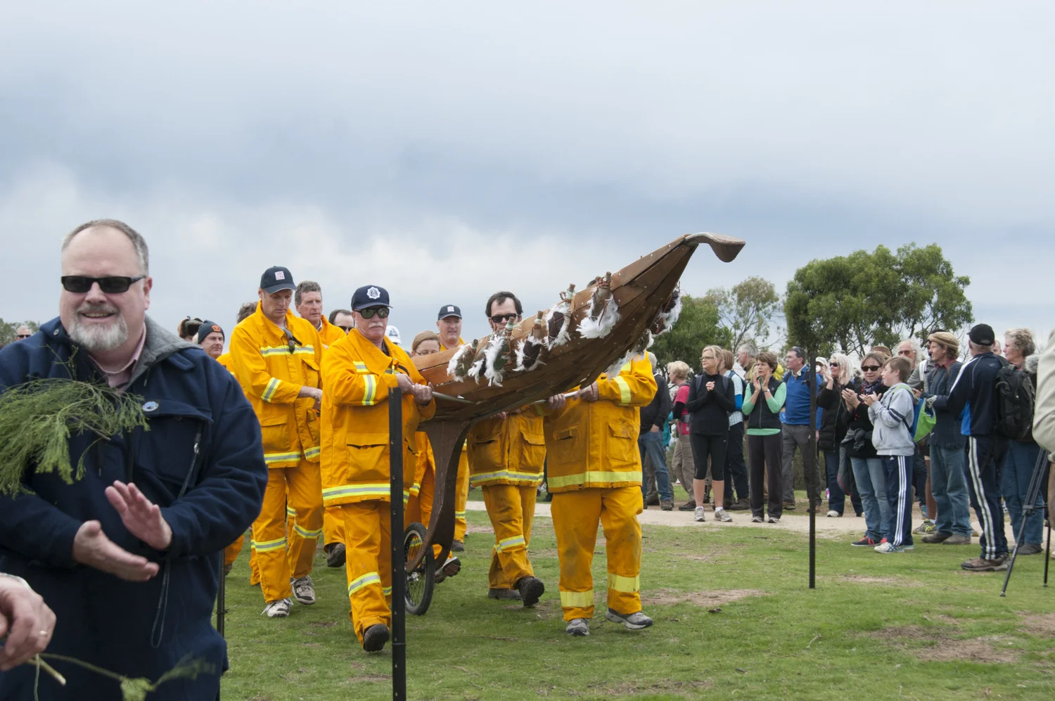
A procession carrying an ephemeral sculpture ‘Canoe’ led the journey.
The walk was divided into 12 stages, separated by 12 Stations where you could rest and refresh. Station opening times and Canoe arrival times can be found on the M~M2014 Timetable.
You could walk the entire distance, or select the stage/s that were suited to your fitness level or interests.
Estimated walking times provided were approximate only and were for an ‘average’ walker moving briskly.
Walking times did not include rest pauses at the Stations.
Preparing for your walk
If you planned to complete the full 80 kilometres over 24 hours, it was highly recommended that you train for several weeks before the event, and consider your physical fitness level.
Careful planning of your walk was recommended, as some stages were more challenging than others.
Registration, Passport and Map
Register with Karingal Foundation for your walk. (Registration is now closed)
When you registered, a beautiful souvenir M~M2014 Passport and detailed map was be ordered for you. Passports could be picked up from the Passport Checkpoint upon arrival at your first Station. You could stamp your M~M2014 Passport at each Station when you completed a stage or finished a walking circle.
Group registrations were open until 5:00pm Friday 2 May 2014.
Download a basic map of the route
A map was also integrated into the free Connecting Memory mobile phone app.
Getting there
It was important to plan in advance for parking and retrieval of your vehicle (if required). Car pooling, pre-arranged pick-ups, and use of taxis may have been helpful.
Parking and Transport
If you intended to walk the full M~M2014 journey over 24 hours we recommended you park in Central Geelong. On Friday 9 May 2014 at 1:00pm a coach departed from VLine Geelong Railway Station, Bus Bay #1 , to take you to Big Rock to be a part of the M~M2014 opening ceremony: Gathering of Elders. You had time to retrieve your Passports before the ceremony started at 2:30pm.
- The coach departed for the return trip to Geelong Railway Station at approximately 3:45pm, after the opening ceremony.
At the completion of M~M2014 at Barwon Heads on Saturday 10 May2014 a coach departed at 7:30pm to take you back to VLine Geelong Railway Station.
Each bus journey was $5 (one way) and was payable in cash on the bus on the day.
If you planned to commence your walk at one of the 12 Stations situated along the route, parking was available close to each one.
You were advised that you park at your own risk - the City of Greater Geelong and M~M2014 event partners did not take responsibility for any theft or damage to cars parked at any of the M~M2014 Stations.
For important details regarding parking at the You Yangs (Station 1) and the Gathering of the Elders ceremony, you needed to please refer to 7. M~M2014 opening ceremony: Gathering of Elders in the Registration Information Kit (available on registration).
Free shuttle buses were available to transport walkers between stations along the entire M~M2014 route. The shuttle buses took walkers back to previous stations that Canoe has passed through on that day (that is: Stations 1-5 on Friday May 9 and Stations 5-12 on Saturday May 10). Note that shuttle buses would not take travellers to stations further along the route, only to previous stations. For alternatives, see our FAQ section.
The buses departed from each station approximately 15 to 20 minutes after Canoe had arrived. You were required to present your M~M2014 Passport to obtain entry to the shuttle buses.
What to bring
You were advised to wear comfortable clothes, suitable footwear, a hat, sunscreen, bottled water and a fully charged mobile phone if you had one. You could also bring money to purchase food at the various vendors along the way.
- Music to Walk By - You could load the M2M Contemporary Songline onto your ipod and bring it along. Beautiful music and songs inspired by our breathtaking Geelong landscape, by Rod Gear, Rose Bygrave, Tiffany Eckhardt, Dave Steel and a bevy of local singers and musicians. CD/DVD set available at all City of Greater Geelong Customer Service Centres, just $25. Here are a few sample tracks.
- Connecting Memory - You could download the Connecting Memory app for iPhone and Android and take your headphones along to hear local voices tell local stories about the places you were passing through.
Amenities
Toilets were available at the 12 Stations, as well as Suma Park railway siding (mid point between Drysdale and Swan Bay).
Feeling hungry?
Food and beverages could be purchased from local vendors at most Stations. Some Stations also featured cafés, restaurants, pubs and venues nearby - be careful not to fall behind though! We also recommended bringing along some snacks such as trail mix, dried fruits etc. to keep you going.
The Central Geelong website had more information on dining, entertainment, accommodation and shopping options in Central Geelong.
Water and hydration
Drinking water was available at all Stations and hot water at some. It was strongly recommended that you carry a water bottle and refill it regularly. You might have also wished to bring electrolyte tablets.
Safety
All care was taken to ensure that the route followed the safest pathways wherever possible. However, you were responsible for your own safety, or that of any minors in your care, while participating in M~M2014. Due caution was recommended, especially where the trail crossed a thoroughfare, where the path was uneven or on loose surfaces, or followed a roadway. Consult the M~M2014 Timetable for details.
Accessibility
The M~M2014 route was plotted via the most accessible route available between Stations wherever possible. However in certain places access may have become more challenging, due to steep gradients or loose or uneven surfaces. People with limited mobility may therefore have prefered to travel by car between some Stations, or chose to complete the Walking Circles rather than follow the route.
The trail between Stations 10, 11 and 12 was across beach sand and should only have been attempted by those with suitable mobility options.
A wide range of accessibility information can be found on our Accessibility page.
Central Geelong maps for people with limited mobility were available from:
Barwon Disability Resource Council, 48 McKillop Street Geelong
All Geelong Visitor Information Centres
Geelong Info Pages
Mobility Maps can also be downloaded from either the Barwon Disability Resource Council's Assert4All website or the Otway Country to Coast website.
General Disclaimer
The M~M2014 Route Map was intended as a general guide to the event journey. Although the content was researched and prepared with due care, the City of Greater Geelong accepted no responsibility for errors or omissions that accidentally occur within this map, or injuries that may have occurred on the route.
Frequently asked questions
If you left your car in Geelong on Day 1 and bused out to the start would shuttle buses take you forward to Geelong if you cannot walk the 30 km distance for the day?
No. Shuttle buses would only travel backwards along the trail to previous stations, to pick up your car.
If you wished to travel forward to stations further along the route, or needed to leave the walk and get directly to Geelong from Walking Stations, you would need to make your own arrangements for transport such as taxi (Geelong Taxi Network or phone 131 008), or travel by car with a friend or family member, or public transport if available.
Could you walk ahead of the canoe out of Lara coming into Geelong finishing earlier than the projected 10:00pm arrival of Canoe?
You were welcome to bypass Canoe - though it moved at a good clip as the timekeeper of the journey.
However if you did, you would do so at your own risk, as the traffic management and safety teams were only there for set times related to Canoe's progress.
Station opening times were also connected to Canoe's progress - see the timetable for more information.
